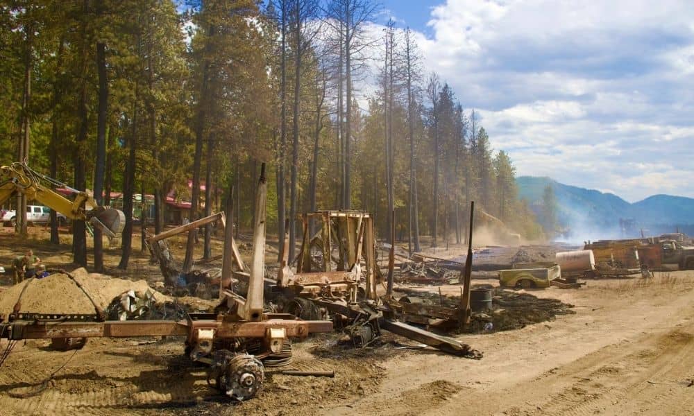
A wildfire does more than remove trees and brush. It strips away the ground cover that normally slows down rain and lets it soak into the soil. Once that cover is gone, rainfall hits bare, scorched ground and runs off much faster than before.
This matters most in places like Southwest Idaho, where hillsides can burn and then face heavy rain within the same year. Fast-moving water on burned slopes can pick up ash, sediment, and loose debris as it travels downhill. That mix can move quickly and reach areas that were never part of the original burn.
A property does not have to sit inside the fire perimeter to feel the effects. If your lot is downhill or downstream from a burned hillside, changed runoff patterns can bring more water, sediment, or debris your way than before the fire.
This is a different issue from being mapped into a FEMA flood zone. A burned watershed can behave differently in a storm even if the property was never officially classified as flood-prone. One is about how water moves after a fire. The other is about a formal designation on a flood map. They can overlap, but they are not the same thing, and a property owner rebuilding after a fire should understand both.
What a Flood Elevation Survey Can Establish at a Rebuild Site
A flood elevation survey gives you measured, site-specific numbers. A licensed surveyor records the elevation of key points on the existing structure, the rebuilt structure, or the building pad itself, using established reference points and methods.
Those measured elevations can then be compared against applicable flood-related reference information, such as base flood elevations shown on FEMA maps, where that information applies to the property.
This kind of field data tells you something a general hazard map cannot. A regional flood map shows broad zones based on modeled data. A survey shows the actual elevation at your specific site, measured on the ground.
That distinction matters for a rebuild. Two lots in the same general area can sit at noticeably different elevations. Only a survey confirms where your particular structure or pad falls in relation to relevant flood elevation data.
What a survey does not do is predict debris-flow behavior. Elevation numbers describe height, not the path or force of a future debris flow. FEMA treats debris-flow assessment and flood elevation information as separate types of analysis, done for different purposes. A flood elevation survey should be read as one piece of information, not a standalone forecast of what a post-fire storm event might do to your property.
When the Old Elevation Data May No Longer Answer the Rebuilding Question
Many properties already have elevation records from a previous survey or an elevation certificate tied to the original construction. After a wildfire, those older numbers may not fully answer the questions a rebuild raises.
A few things can change the picture:
- Was the property itself directly affected by the fire, or only by changes in the surrounding watershed?
- Has sediment or debris altered nearby drainage paths since the original survey was done?
- Has grading, erosion, or fire-related ground disturbance changed the site’s physical conditions?
- Does the current rebuilding project need field information that reflects present-day conditions rather than conditions from years ago?
- Is the project being reviewed under current local requirements, which may differ from the standards in place when the property was first built?
None of this means every burned property automatically needs a brand new survey. Some sites will still be well represented by existing records. But when site conditions have shifted, or when a rebuilding project needs current information for permitting or design, updated field data can close the gap between what the old records show and what the site looks like today.
Reading Elevation Information Alongside Post-Fire Hazard Information
Rebuilding decisions near a burn scar usually draw on more than one type of information. A flood elevation survey is one piece. It sits alongside other sources that each answer a different question.
Here is roughly how they divide:
- Surveyed site elevations show the measured height of the structure or pad at your specific property.
- FEMA flood mapping, where it applies, shows the broader flood zone designation for the area.
- Local floodplain requirements set the rules a rebuild project must meet in that jurisdiction.
- Post-wildfire hazard assessments address debris-flow and erosion risk tied to the burned watershed.
- Drainage and watershed information describes how water moves across and around the property after the fire.
- Engineering or geologic evaluations, when appropriate, look at slope stability and ground conditions in more depth.
No single item on that list covers everything a rebuild near a burn scar might require. A flood elevation survey gives you accurate, measured elevation data. It does not, by itself, determine whether the site faces debris-flow risk or how the surrounding watershed will behave in the next major storm. Those questions call for the other types of information listed above, brought together by the right professionals for each piece.
Before Rebuilding, Match the Survey to the Actual Site Question
Start by identifying what the rebuild actually needs to establish. Elevation for a permit application is a different question than elevation for insurance purposes, and both are different from a general check on where your structure sits relative to nearby drainage.
From there, confirm which elevation information the reviewing authority or your design professional actually requires. Building departments, engineers, and insurers do not always need the same data, so it helps to know the specific requirement before the survey work begins.
Give the surveyor the property and project details you already have. Prior surveys, site plans, permit history, and any post-fire assessments already completed all help the surveyor scope the work correctly and avoid duplicating information you already possess.
Ask whether additional engineering, drainage, geologic, or hazard analysis is needed alongside the survey. On a burned watershed, elevation data usually works best as part of a broader picture rather than as the only input into a rebuilding decision.
Once the elevation data is in hand, use it as one part of the rebuilding process. Combined with the right hazard and engineering information for your site, it gives you a clearer, more complete basis for moving forward.
Frequently Asked Questions
Can a burn scar affect flood conditions on a property that did not burn?
Yes, potentially. Changes in runoff and sediment movement after a wildfire can extend beyond the burned footprint. A property downstream or downslope from a burn scar may warrant a closer look, since FEMA has noted increased flood and debris-flow concerns in the aftermath of wildfires.
Does rebuilding after a wildfire automatically require a flood elevation survey?
Not automatically. Whether a survey is needed depends on the property, the specifics of the rebuilding project, and the applicable local requirements. A survey becomes useful when the project needs accurate, current elevation information to move forward.
Can a flood elevation survey predict a post-fire debris flow?
No. A survey provides measured information about existing physical conditions and elevations at the site. It is not a substitute for a dedicated post-wildfire debris-flow, hydrologic, geologic, or engineering assessment.