
Meridian is growing fast again. The city council just approved the next phase of the Pine 43 development, a large mixed-use project with new apartments, shops, and a hotel near Pine Avenue and The Village. For builders and investors, it’s another sign that Meridian is booming. But before any construction begins, one important step can’t be skipped — the ALTA Survey.
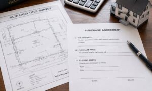
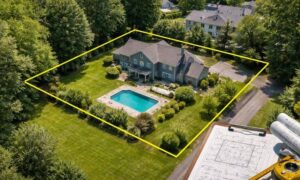
An alta survey is more than a map of property lines. It’s a detailed report that shows lenders, engineers, and city planners exactly where the land begins, where it ends, and what sits in between. It protects builders and property owners from hidden issues like easements, wrong boundaries, or outdated plats that could slow down a project.
Meridian’s Growth and What It Means for Builders
Meridian is one of Idaho’s fastest-growing cities. New neighborhoods, stores, and offices are appearing all over Ada County. With so many projects happening at once, construction often takes place on land with complicated records, multiple owners, or shared utilities.
That’s when mistakes can happen. Even a few feet of error in a boundary can delay permits, require redesigns, or create disputes once the building starts. The Pine 43 expansion is a perfect example. It connects to busy roads and nearby homes, which makes surveying accuracy even more important. A clear ALTA Survey helps everyone build with confidence.
What an ALTA Survey Does
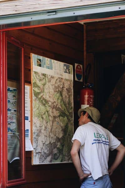
An ALTA Survey (short for American Land Title Association Survey) combines boundary measurements, title research, and on-site mapping into one complete report.
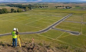
Surveyors start by checking the deed, the title commitment, and county plats. Then they visit the site to measure corners, locate buildings, and identify every recorded easement.
This process gives everyone involved — lenders, engineers, and city reviewers — the same clear picture of the land. For large projects like Pine 43, the ALTA Survey acts as the main base map for design and construction. Without it, builders might rely on old or inaccurate maps, which can lead to problems later on.
Why the Pine 43 Project Makes ALTA Surveys Essential
The Pine 43 expansion will reshape part of Meridian’s busiest area. The site sits near major roads and existing neighborhoods, which means multiple agencies and property owners share access and utilities. Each of them has different legal boundaries and right-of-way rules.
An ALTA Survey ties all of this together. It combines public records with real-world measurements so everyone — from city planners to contractors — works from the same information.
Here’s why that matters:
- Road and Utility Coordination. The Ada County Highway District and Idaho Transportation Department often update road and drainage plans near big projects. The ALTA Survey ensures that new designs match current rights-of-way and avoid future conflicts.
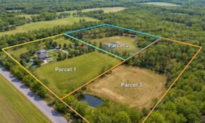
- Multiple Parcels. Pine 43 includes several parcels of land. The survey shows where those parcels connect, preventing overlap or confusion when the city reviews the plans.
- Construction Staking. Builders rely on precise coordinates to place structures, sidewalks, and utilities. The ALTA Survey provides those measurements early, before ground work begins.
In short, the survey keeps everyone aligned and helps construction move forward smoothly.
Three Common Problems ALTA Surveys Help Prevent
1. Hidden Easements. Many properties have irrigation or utility easements that aren’t easy to spot. Building over one of these areas can bring your project to a halt. An ALTA Survey maps them clearly so you can adjust your design long before permit review.
2. Outdated Control Points. As new neighborhoods rise and streets expand, some of Meridian’s old survey markers get disturbed or even removed. ALTA Survey crews replace or re-check those points to make sure your boundary lines still match what’s on record with Ada County.
3. Overlapping Boundaries. In older parts of the Treasure Valley, some plats don’t line up perfectly with newer developments. That mismatch can cause overlapping boundaries between properties—something you might not notice until a fence, driveway, or utility crosses the line. An ALTA Survey resolves these gray areas by confirming where each parcel truly begins and ends. It ties your legal description to what’s actually on the ground, protecting you from future boundary disputes or title issues.
When to Order an ALTA Survey
The best time to order the survey is early — ideally before design or financing is complete. Once you’ve secured zoning or entitlements, it’s time to bring in a licensed land surveyor.
Ordering late can cause delays. It often means redesigning site plans, resubmitting permits, or waiting for the lender’s approval. For a big project like Pine 43, surveyors start months ahead of construction to make sure every detail is ready when crews arrive.
Even smaller projects benefit from early planning. Meridian survey teams get busy during building season, so booking your survey ahead of time keeps your project on schedule.
Choosing the Right Surveyor
Not every surveyor performs ALTA-level work. You’ll want someone licensed with experience in commercial or subdivision projects. Local knowledge matters because surveyors must coordinate with the Ada County Highway District, city planners, and utility providers.
When you meet your surveyor, share what you already have — title reports, site plans, and your expected timeline. The more details they have, the faster they can deliver accurate results.
A skilled local surveyor will also provide digital files (like CAD maps) that your engineers can use directly. This coordination between survey and design saves hours of work and prevents errors down the road.
How an ALTA Survey Saves Time and Money
At first, the ALTA Survey might look like an extra cost. But it’s actually one of the smartest investments a builder can make.
Without it, you risk building in the wrong spot or discovering easement conflicts halfway through construction. Fixing those mistakes after the fact can cost thousands of dollars and weeks of delay.
The ALTA Survey helps you avoid redesigns, legal headaches, and lost time. It gives lenders confidence in the project and ensures that every inch of your site matches legal and title records. It’s peace of mind that pays for itself.
Meridian’s Growth Calls for Smarter Planning
Every year, more builders choose Meridian because it’s full of opportunity. But with rapid growth comes more complex zoning rules, overlapping utilities, and tight schedules. Projects like Pine 43 involve dozens of partners — engineers, contractors, city officials, and lenders.
An ALTA Survey is what keeps all those moving parts in sync. It turns a patchwork of maps and records into one reliable document. In a city growing as quickly as Meridian, that accuracy matters more than ever.
Final Thoughts
The Pine 43 development is just one sign of how fast Meridian is expanding. New buildings bring new chances — and new risks. Ordering an ALTA Survey before construction starts is the easiest way to stay ahead of both.
It gives you a clear, verified view of your land so you can build with confidence. It keeps lenders happy, engineers accurate, and contractors on time. Most of all, it helps your project start — and finish — on solid ground.
If you’re planning to build, don’t wait for problems to appear. Order your ALTA Survey early and protect your investment from the start.