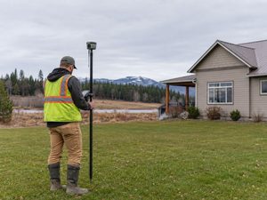
If you’ve ever scrolled through Reddit, you’ve probably seen a flood of frustrated homeowners venting about fences and neighbors. In Idaho, it’s no different. Posts about ripped-out stakes, surprise fences, and “my land vs. your land” arguments keep popping up. What many people don’t realize is that these conflicts often come down to one thing: a lack of clarity about where the property line really is. That’s where an alta title survey comes in. While most folks only think about surveys when buying a home, this type of survey goes much deeper. It doesn’t just mark corners in the ground. It maps out boundaries, easements, rights-of-way, and encroachments. In other words, it’s the document that can save you from a long, expensive fight with your neighbor.
Why Fences Spark So Many Disputes
Idaho is full of fast-growing neighborhoods, farmland being divided, and rural properties with long fence lines. It sounds simple—just put a fence where the line is. But here’s the problem: most fences are built by contractors or homeowners, not by surveyors. That means a lot of them don’t sit exactly on the legal boundary.
Neighbors notice when a fence “eats” a few feet of their yard, or when a new stake shows up where they didn’t expect it. Suddenly, something that started as a simple post-hole project turns into a heated conflict. One side insists the fence is right, the other swears it’s wrong. Without proper documentation, the argument can drag on for months.
What People Think a Survey Shows vs. What It Actually Does
Many homeowners believe that if they “get a survey,” they’ll immediately have proof that settles everything. But not all surveys are the same. A quick boundary survey might only locate and mark the corners. That’s useful, but it doesn’t always address the bigger picture—like recorded easements, utility lines, or overlapping property claims.
An alta title survey, however, is much more comprehensive. It’s the survey that lenders, title companies, and attorneys rely on because it follows national standards. It documents not only where the corners sit, but also every legal detail tied to the property. In a boundary fight, this survey becomes the strongest evidence you can have.
When a Neighbor Demands a “Quick Fix”
Imagine this: your neighbor marches over and says, “Your fence is on my land—move it by the weekend.” That’s exactly the kind of scenario that people post about online. The instinct might be to avoid conflict and start moving posts, but that could be a big mistake.
Here’s a smarter path. First, call the surveyor who worked on your property. If you already have an ALTA Title Surveys, pull it out and review it. It will show more than just corners—it will tie those corners to the recorded plats, past surveys, and the county’s legal records. That’s the kind of evidence that can stop a dispute before it spirals out of control.
What If Stakes Go Missing?

One of the most frustrating complaints on Reddit comes from people who discover their survey stakes have “mysteriously” disappeared. In Idaho, removing or defacing a survey monument is not just bad manners—it’s illegal. State law makes it clear: moving a monument is a serious offense.
If this happens to you, don’t panic. Document everything with photos. Call your surveyor right away and let them know what’s missing. They can replace the markers and provide documentation that shows tampering occurred. If things escalate, you have the legal backing of both your survey and Idaho law on your side.
How the Paper Trail Helps
The beauty of an ALTA Title Survey is that it doesn’t stand alone. It connects directly to the public record. In Ada County, for example, you can look up past surveys, plats, and recorded documents online. By linking today’s survey with older records, you can prove continuity and accuracy.
That’s powerful in a boundary fight. Neighbors may argue about where a fence should sit, but a recorded survey that ties back to decades of records carries weight. It’s not just your word against theirs—it’s a legal trail that shows where the line has always been.
Practical Steps for Homeowners
Nobody likes conflict, especially when it’s literally sitting in their backyard. While every situation is unique, a few practical steps can help.
- Keep records handy. If you have an ALTA Title Survey, store it with your property documents. It will save time if questions come up.
- Talk before you dig. If you or your neighbor plan to build or replace a fence, bring the survey into the conversation first.
- Document issues. Take photos of fence lines, stakes, and any changes. It creates a timeline that supports your case.
- Stay calm and professional. Sometimes all it takes is showing the official survey to de-escalate tension.
Why an ALTA Title Survey Is Worth It
Some homeowners hesitate to order an ALTA Title Survey because it costs more than a basic boundary survey. But consider the alternative. A boundary fight can lead to attorney fees, court appearances, and strained relationships with neighbors. Compared to that, investing in a detailed, legally recognized survey is a bargain.
It also protects you beyond just fences. Easements, encroachments, and title issues often come up during construction or property sales. By having this survey in hand, you’re covering yourself for the long term, not just for today’s argument.
Conclusion
Fence disputes are stressful, and homeowners are seeing just how common they can be. The good news is that you don’t have to rely on shaky memories, old fences, or neighborhood gossip to prove your property rights. ALTA Title Surveys provide clarity, legal protection, and peace of mind.
So the next time someone questions where your fence sits, you’ll have more than just your opinion to back it up—you’ll have the document that speaks louder than arguments.